About Us Customers

 uniDEM

User Manual Window Overview uniDEM Logo Table of Contents
Tutorials

uniDEM Basic Classification

uniDEM supports the selection and assignment of land use classications to a 2D raster mask called CLASS associated with the active DEM layer.

Assign Class

Assign the desired classification to all selected pixels.

Default shortcut: none

Set Class Z (elevation)

Sets all elevation values of chosen land use class values within a selection area are set to the terrain height specified.

Default shortcut: none

Enforce Boundaries

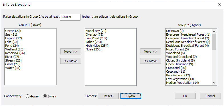
Sets all elevation values at boundaries from one land use classification to another. For example hydrological modelling requires all land pixels adjacent to water are set to an elevation that is equal to or greater than the height of the water.

The tool is generalized to allow elevations of class(es) adjacent to other types. For example water types adjacent to land types can be modified together. dem enforcement parameters

Usage:
  1. Enter the elevation to raise CLASS neighbours in Group 2 by when lower than CLASS neighbours in Group 1
  2. Separate classifications into Group 1 (for example water types) and Group 2 (for example land types) as appropriate based on the editing constraints appropriate to the project.
    • DEM pixels classified as a type in Group 2 are checked against neighbour classifications in Group 1
    • The elevation in Group 2 will be raised above the height of the highest Group 1 neighbour if the height is lower
  3. Select 4 or 8 way connectivity
  4. Select Hydro button if shoreline containment is the goal and default classifications are used
  5. Select Reset button to reset Groups to empty

Default shortcut: none