uniDEM Tutorials
The following tutorials provide step by step walkthroughs intended to present aid in uniDEM usage and process development.
They are incremental from data loading through editing and analysis.
Getting Started
These examples provide introductory guides to introduce the methods to load and interact with geospatial datasets in uniDEM.
A brief introduction describing how to install and use uniDEM.
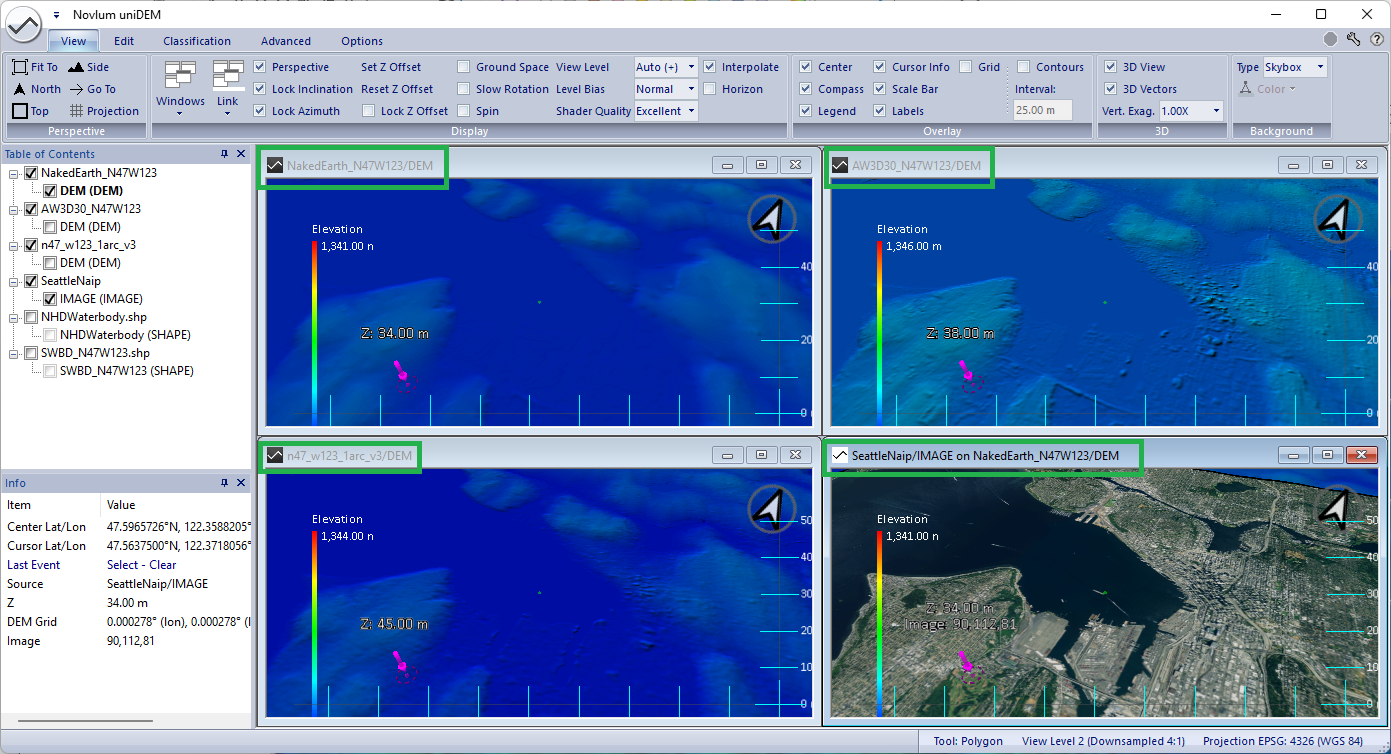
- Load a digital elevation model (DEM)
- View the DEM
- Zoom, pan and rotate
- Toggle between 2D and 3D views
Learn how to select areas using different selection tools and options to perform DEM edits.
- Select using drawing tools like polygons and rectangles
- Select using flood filling
- Select All
- Undo
- Clear selection
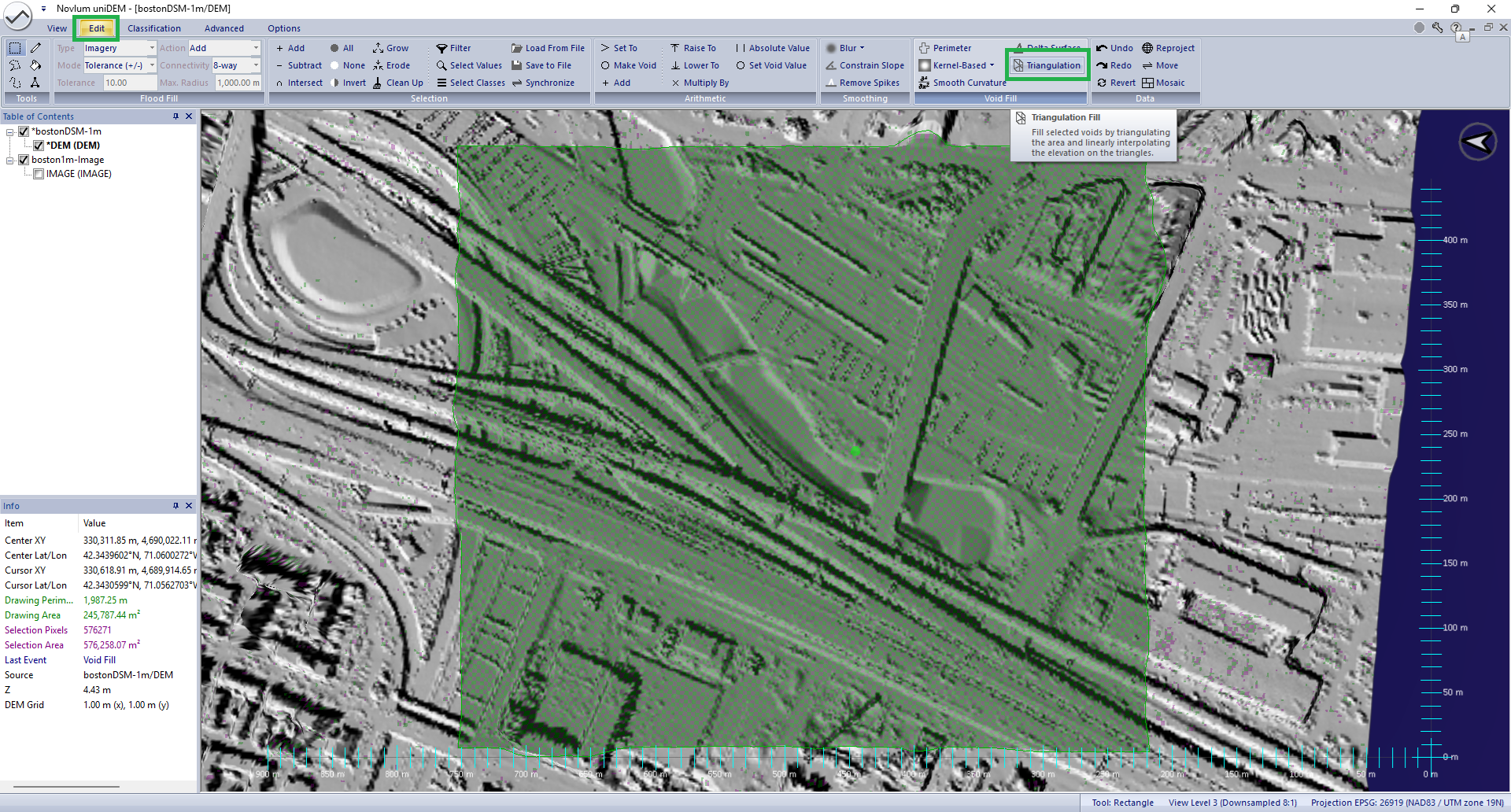
Learn how to fill voids in a Digital Surface Model (DSM) by interpolation
- Fill within a square (kernel) region
- Fill using tringulation
DEM Editing
These examples provide a guide to editing elevation data in gridded format (DEM) using uniDEM.
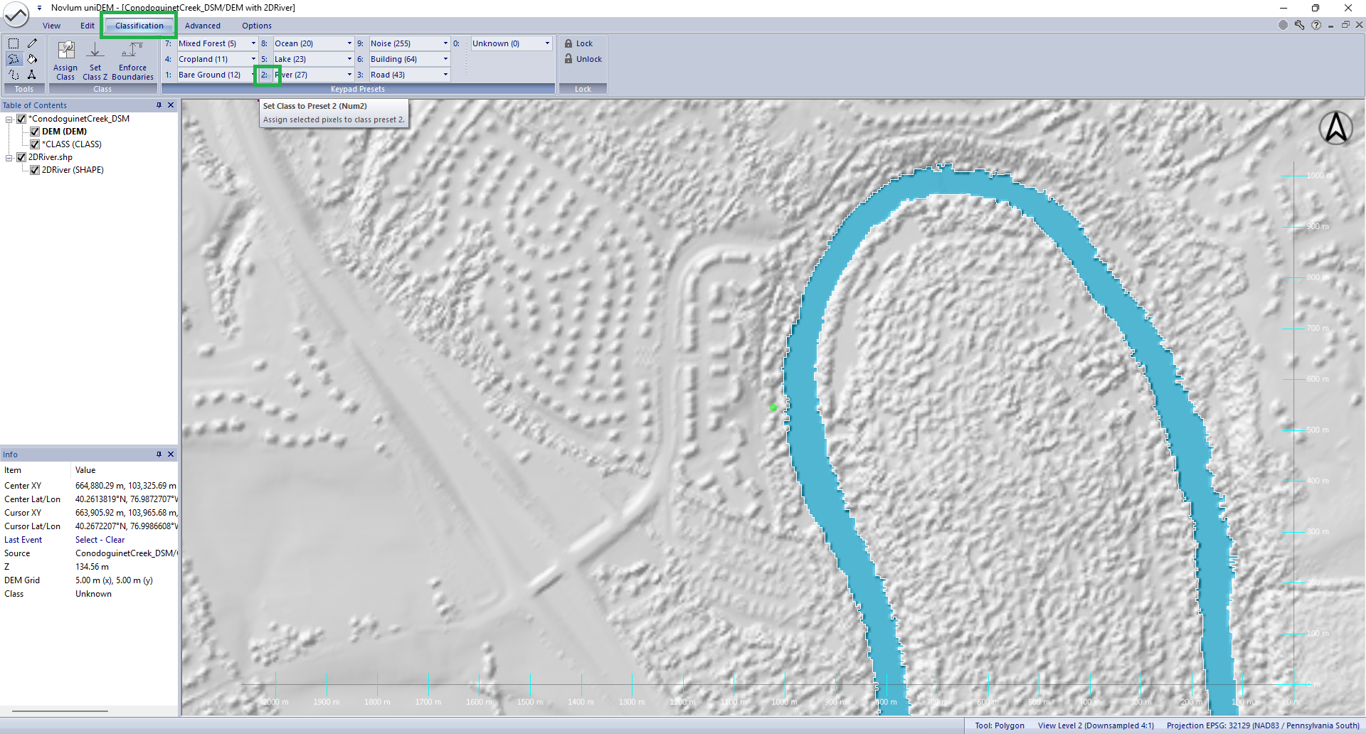
Water must be flat, and flowing water like rivers and streams must flow downhill.
- Classify river using 2D shapefiles
- Flatten rivers provided flow in the DEM
- Ensure water containment by raising shorelines
- Export 3D water breaklines as shapefiles
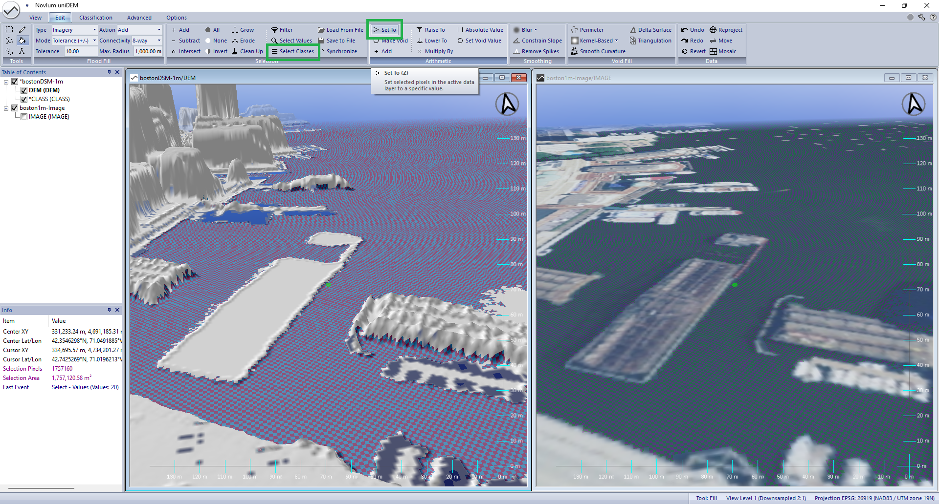
Water must be flattened to an equal elevation for standing water such as lakes and oceans.
- Classify Water as Ocean using Floodfill
- Clean up Misclassifications
- Edit Water Heights
- Contain water by raising shorelines
- Ensure water containment by raising shorelines